

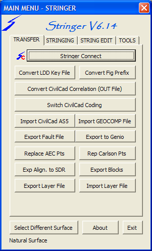
Transfer Menu - Click on a Tab |
 |
Convert LDD Key File |
Allows the user to select a Key Description file created in Land Desktop to be imported into Civil 3D. For future convenience this process should be carried out on a new drawing after which the imported file information can be saved to a drawing template. | ||||||
Convert Civil Cad Correlation |
Allows the users to select a CivilCad Correlation file (OUT) to be imported into Civil 3D Key Description file with associated Point Styles. Shown below is a sample of the required format for the file. CIVILCAD 5 Job JOB1091 Date 11/03/04 12:15:02 File C:\CCAD572\TEMP\JOB1091.OUT Job details 11/03/04 BLACK WEIR PARK DETAIL SURVEY Code Description Layer Symbol 1 2 3 4 5 6 7 8 9 10
. . . . . . . . . .
BB BOTTOM OF BANK BANK none 3 2 P S C B Y Y Y
BDY BOUNDARY LINES BDY $CIR1 1 0 P S C Y Y Y
BIN PERM BIN BASE $CIR2 15 0 P S C Y Y Y
BLD BUILDING BUILD none 2 0 P S C B Y Y
BM BENCH MARK SURMK $CIR1 14 0 P S C Y Y Y
BU BUILDING BUILD none 2 0 P S C Y Y Y
BUS BUS SHELTER FEAT none 12 0 P S C Y Y Y
CG CHANGE GRADE LEVEL none 15 0 P S C B Y Y Y Y |
||||||
Switch Civil Cad Coding |
Many existing data sets have the string number precede the description code to suit requirements of different software packages. Stringer requires the numeric String number to be after the code. This function will swap the code with the string number. Note that it is only applicable with alpha codes as Stringer will string any numeric code with a minimum of 4 digits by default or one more digit than the number referenced in the Numeric.dat file. Example 01EB becomes EB01 or, for numeric coding, 01102 becomes 10201 |
||||||
Import CivilCad AS5 |
Allows the user to select a Civilcad ASCII 5 file (AS5) to be imported into Civil 3D, creating a point group called CIVILCAD_<filename> and a surface, also called CIVILCAD_<filename>. The point group is created with all points, and then excludes the points flagged in the CivilCad file as non-Contourable. This point group is associated with the new surface, which also has the breaklines added. The result is a surface that reflects the build information in the as5 file. | ||||||
Import Geocomp File |
Allows the user to import a GEOCOMP file (PTS and STR) into Civil 3D, bringing in points and strings
|
||||||
Export Breaklines to Fault File |
Creates a fault file (*.flt) of the breaklines that are in the
selected Surface. If only one surface exists then the surface selection
is automatic
#Stringer Fault file from Surface SURVEY |
||||||
Replace AEC Points
|
Each of the point markers assigned from the Point Styles are also inserted, with the programme attempting to emulate the scale and rotation of the symbols. The layer for the symbol is also used. |
||||||
Replace Carlson Points |
Replaces all Carlson points with Civil3D points |
||||||
Export Block |
Exports all Blocks in the current drawing to individual drawing files. It is effectively an automated wblock. |
||||||
Import/Export Layers
|
Exports all of the layers in the current drawing to a CSV file, which can then be imported into a new drawing, or, more likely, a drawing file from a client that does not use your layer structure.
|